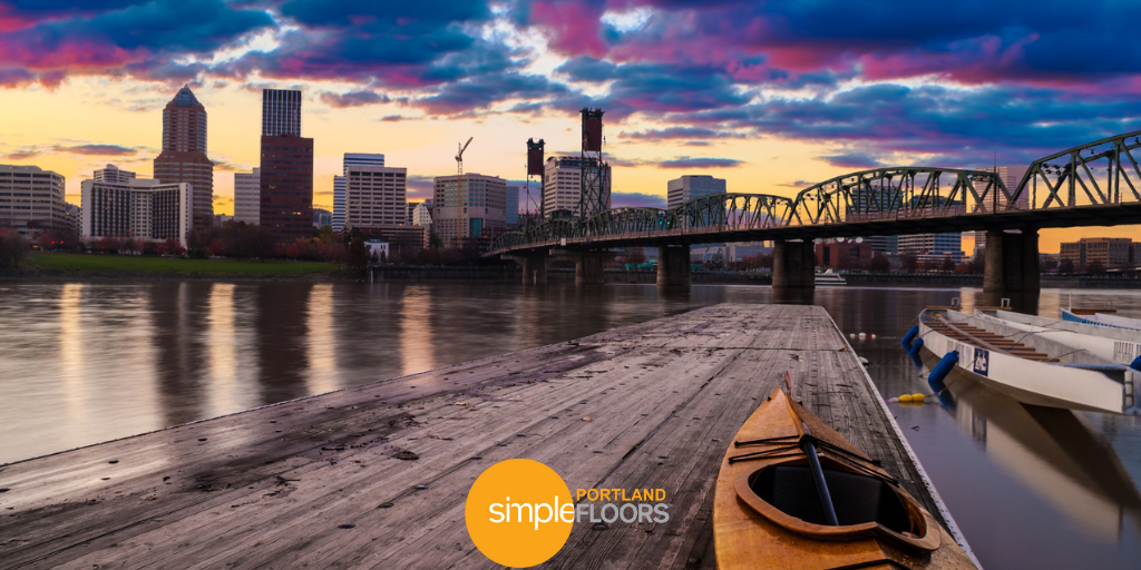
The Willamette River is a vital feature of our state. After all, 70% of us live in the Willamette Valley, and most of us prosper within 20 minutes of the riverbed.
Stretching 187 miles, it is the 13th largest river in the United States by volume and has the second-largest waterfall by volume in the country. Both Coastal Fork and Middle Fork converge to become the Willamette River. Starting south of Springfield, the mouth of the Willamette begins near Dorris Ranch. The river cuts through Eugene, proceeding through over a dozen different regions, including Albany, Portland, and Oregon City — winding its way through our most populous areas. The basin is the largest in the state, the watershed draining 11,487 square miles. You can watch an aerial tour of Willamette, concluding in the Columbia River below.
Early Origins
A boulder at Alton Baker Park in Eugene is engraved with the original Kalapuyan term “Whilamut”, meaning “where the river ripples and runs fast.” For 10,000 years, the valley experienced planned burnings by the native inhabitants to make room for lush and green prairie grasses every winter. Starting as early as 1792, the rivers were involved in the fur trade, where fur trappers often hunted for beaver and sea otters through the streams and coastlines. Fishing was plentiful in the waters, but diminished significantly after the dams were installed in the territory. Salmon and steelheads were most commonly consumed.
Settlers resided in the area during the 1800s, viewing the river as an important transportation corridor. Their arrival followed the Oregon Trail, the winding country-spanning path that concluded at the mouth of the Willamette. In 1843, large-scale migration saw 1,000 pioneers head westward. The next quarter-century attracted half a million settlers risking the pilgrimage.
Development
Oregon City was built in 1820 near the Willamette Falls. Paper mills helped the city initially prosper, deriving their power source from energy generated by the waters.
Paddle-wheeled steamboats took wheat to the market and imported further settlers. Navigation on the river was divided into two stretches: a 27-mile lower stretch from Portland to Oregon City; an upper reach, that encompassed a majority of Willamette’s length.
By the late 1850s, farmers began to grow crops and consume the available fertile land. Skirmishes between natives and local government was commonplace. Eventually, natives were relocated to the hastily created Grand Ronde Reservation.
Charting
From 1879-1885, the Willamette River was charted by Cleveland S. Rockwell. Assigned by the U.S. Coast and Geodetic Survey, the topographical engineer surveyed the river from the foot of Ross Island through Portland; to the Columbia River and Bachelor Island. The extremely detailed survey included 17,782 hydrographic soundings.
The work on both the Willamette and Columbia tributaries reposted buoys and channels, making passage much safer throughout our state. His work also contributed to Portland opening for commerce, impressing with its industrial might. Now, Portland is the most urbanized part of the watershed and is situated at the lower end of the drainage basin, positioned as a critical portion for the region’s fish and wildlife.
Modern Changes
Throughout the 20th century, towns and residents populated the banks. Most inhabitants viewed the Willamette annual flooding as a nuisance. During winter and spring seasons, the river ran wild, overflowing to reflect 40-50 inches of seasonal precipitation. In the 1940s, the river was harnessed via the first constructed dams. In particular, the Army operated 13 dams, affecting the flow from about 40% of the basin.
Levees were constructed in most urban areas. The postwar economy saw increased sewage, as well as development directly resulting in permanent damage to the floodplain. The late 1930s saw the formation of a state sanitary board to stem pollution. In 1967, a Willamette Greenway was put into the works, creating an improved system of parks, trails, and wildlife refuges along the river.
Willamette Water Trail
In 1998, the Willamette was designated an American Heritage River — one of 14 rivers to receive the title. By 2007, the Greenway expanded to 170 separate land parcels, including 10 state parks. This directly led to the Willamette River Water Trail being created the next year, followed by an expanded 217-mile stretch that included major water tributaries.
Pollution
An Oregonian report from 1906 called the river a “common sewer for the entire valley.” The river was named one of the most polluted in the country by EPA, containing 65 chemicals that risked human and environmental health, including petroleum, pesticides, and heavy metals.
Over the last 30 years, efforts have continued to be implemented via stringent environmental protection laws and restoration activities to improve the water quality conditions. These have included: studies, cleanup efforts, and coordination by regulatory agencies and water providers.
Both a pipeline and a water treatment plant are in varying stages of construction. The water supply system will officially be online by 2026.
Wine
Willamette Valley is the focal point of our state’s wine-growing. The area yields 2/3 of our overall wine production and hosts 19 approved wine-growing areas that stretch across the river. In total, there are 725 Oregon wineries and more than 1,000 vineyards growing 72 varieties of grape — chief among them is Pinot Noir.
If you’d like to learn more about the beautiful Willamette River, watch this video we put together:
Want to learn more about Portland? Read, “Fun Facts About Portland You Probably Didn’t Know.”